Orlando Weather: A Friday of Severe Thunderstorms and Potential Damage
As residents of Central Florida prepare for their day, the National Weather Service (NWS) has issued critical updates regarding severe weather conditions, particularly in Orlando and surrounding areas. A series of thunderstorms capable of producing hail and damaging winds are expected to sweep across the region on Friday. This article provides an overview of the expected weather impacts, safety tips, and what residents should be aware of as they navigate through this challenging weather day.
Severe Thunderstorm Warnings Issued
This morning, meteorologists have reported significant weather activity developing across Central Florida, with severe thunderstorm warnings issued for multiple counties. These warnings indicate that conditions are creating an environment conducive to severe storms that can produce destructive winds exceeding 60 mph and hail up to the size of quarters.
In Orlando, the afternoon is expected to see an intensity increase in the storms, bringing potential flash flooding, power outages, and hazardous driving conditions. The weather system causing these thunderstorms is a cold front moving through the area, combining with warm, moist air from the Gulf of Mexico, leading to updrafts capable of severe storm development.
The Timeline of Weather Impacts
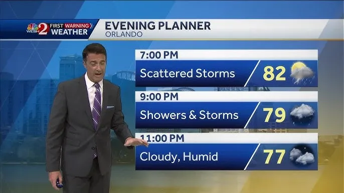
As the day unfolds, residents can expect thunderstorms to roll in during the late morning and early afternoon hours. Meteorologists advise keeping an eye on weather updates, as the storms are anticipated to peak around lunchtime, with the most severe conditions likely lasting until mid-afternoon.
By midday, the storm system is expected to start clearing out, leading to partly cloudy conditions by late afternoon. However, it is crucial to remain vigilant until the storms dissipate completely. Strong winds and heavy rain can affect visibility and lead to hazardous driving conditions.
Potential for Hail and Damaging Winds
The possibility of hail and damaging winds is a significant concern with this weather system. Hail can vary in size, with the potential to cause property damage, especially to vehicles and roofs. Residents are encouraged to seek shelter in garages or covered areas to protect their cars and outdoor equipment.
Moreover, gusty winds can create dangerous situations, such as downed trees and power lines. The storm’s intensity raises the risk of widespread power outages, so residents should prepare accordingly, having flashlights, batteries, and emergency supplies readily available.
Safety Tips for Severe Weather
As strong thunderstorms approach, it is essential to prioritize safety. Here are some tips for residents to consider:
- Stay informed: Keep a battery-operated weather radio or your smartphone handy to track updates from the NWS and local meteorologists.
- Seek shelter: Find a sturdy building to enter during severe storms and avoid using windows as lightning can pose a threat. Basements and interior rooms are ideal.
- Have an emergency kit: Prepare a kit that includes water, non-perishable food, medications, and a flashlight with extra batteries.
- Avoid travel during severe storms: If possible, stay off the roads when storms approach. If you must drive, exercise caution and be mindful of flooding.
After the Storm: What to Expect
Once the severe weather has passed, Central Florida residents should be prepared for potential clean-up efforts. With high winds, it’s common for debris such as branches to clutter roads and sidewalks. It is recommended to exercise caution when venturing outside for cleanup to avoid hazards, including downed power lines.
Additionally, as the storms move out, be aware that after-effects may include localized flooding. Areas with poor drainage systems can experience ponding, so stay informed about road closures and safety hazards.
Looking Ahead: Extended Forecast
After this round of severe weather, Central Florida can expect a return to typical fall temperatures over the weekend. As the weekend approaches, sunny skies and cooler temperatures are forecasted. Residents should take the opportunity to assess their homes and property for any damage caused by the storms. Secure any loose items in the yard and prepare for potentially windy conditions as another front moves through next week.
Conclusion
This Friday marks a challenge for Orlando and the surrounding areas, with strong thunderstorms, hail, and damaging winds expected to impact daily life. Residents must remain alert, adhere to safety recommendations, and prepare for the potential aftermath of this severe weather event. As always, the safety and well-being of the community come first, and being prepared can make all the difference in navigating through these weather challenges.
Stay safe and stay informed – Central Florida’s weather can change rapidly, and being aware of potential hazards makes for a more secure community.


